Showing posts with label mountains. Show all posts

Wednesday, June 20, 2018

The Shane Cabin


Linda and I stayed in Jackson Hole, Wyoming for two nights so we could explore Grand Teton National Park.  After seeing most of the popular sights we left the crowds and drove to the Gros Ventre River Road.  Here we found a cluster of three log buildings popularly known as the Shane cabin.

This is an old homestead with a remarkable history in popular culture.  It started In 1916 when Luther Taylor homesteaded here.


Extra care was made to make the cabin comfortable.  The inside of each log was flattened, insulated with newspapers, whitewashed and covered with layers of decorative wallpaper.  The marks of the ax or adze can still be seen, but the paper covering is gone.  Through a window we could see one of the outbuildings.


In 1948 the property was sold to rancher Andy Chambers and his son Roy, who rented the cabin out for a couple of years.  The cabin had been vacant for a while when it was used in the 1953 movie "Shane" and has been abandoned since then.  The black and white photo shows the other remaining outbuilding.


This beautiful view of the Grand Tetons was probably one reason the cabin was selected for the iconic western movie, thought by many to be one of the best ever.

Now the cabin is returning to the earth.  The roof and floor are gone, and the cabin’s floor joists balance on a few remaining foundation rocks.  No one has tried to preserve the site and there isn’t even a sign to describe its wonderful history as a homestead and then a movie star.

Please be aware that these photos are copyrighted.  They must not be used without my permission.

Sunday, October 30, 2016

Meadow Lake Petroglyphs, California

One of our adventures during our fall camping trip was a visit to the Meadow Lake petroglyphs in the northern Sierra Nevada mountains of California.
Getting there was half the fun.  After about 10 miles of dirt roads, we passed Meadow Lake and continued toward a large area of exposed granite.  Soon we found that the road was blocked by a fallen tree.  Bruce hooked on with a tow strap, broke it, and moved it aside.
Eventually we reached a large open area of granite boulders, with hundreds of petroglyphs on the horizontal surfaces.
The rock art at this site is described as Style 7, High Sierra Abstract-Representational petroglyphs identified with the Martis culture dating from 2000 B.C. to 1000 A.D.  We can guess at their meaning, but no one knows for sure.

The petroglyphs here show up best on areas of dark desert varnish, but careful inspection reveals many on the lighter colored rock as well.  The light scratches around the edge are glacial striations caused by rocks embedded in the base of moving glaciers.

The area is rocky and rugged.  Not many trees grow in this granite, and there are quite a few dead snags and fallen trees.  Their wood often has beautifully weathered patterns.


Why are there so many petroglyphs here?  Perhaps this nearby pond is a clue.  Maybe there was a larger wetland here many years ago, providing a water source for game animals.


 Or maybe it was a good place to camp with drinking water nearby.


  We don’t know the meaning of this rock art, but it sure is fun to find it and take pictures.


These photos are copyrighted, so please do not copy them or use them without my permission.

Monday, October 24, 2016

Humboldt City, Nevada

About 500 people lived here once, but Humboldt City has been a ghost town since the post office was removed in 1869.  Silver was discovered here in 1860, and the city was built here to support several mines.  But, it didn’t last long.
A dirt road runs from the valley through the center of town.
Humboldt City is located along a creek that runs through a canyon high on a mountain in the Humboldt Range of Nevada.  There were 200 buildings here, and now you can still find many rock ruins scattered through the underbrush and on the hillsides.
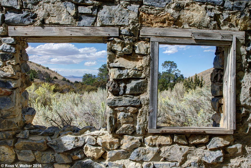
Some of them, like this one with the double windows, have signs that people tried to move in here long after the city was abandoned.  We found a cinder block fireplace added to this old rock wall.
This cabin also has some modern materials like rusty window screens.  It was hard to get to because it was built in a deep gully next to the creek.  I don’t understand why it wasn’t washed away years ago.
There were two hotels here; the Coulter House and the Iowa House.  I’m guessing that this ruin was one of them because of the large front room and a smaller room in back that could have been a kitchen.
The view from the hotel looked up the canyon toward the mountains where the mines were located.  It looks like it has been a long time since the last “No Vacancy” sign went up.

Humboldt City is just a couple of miles from busy Highway 80, near Mill City, Nevada, but being there is like being in a different world.

Remember, all my photos are copyrighted.  Please do not use them for any purpose without permission.

Wednesday, October 19, 2016

Angel Lake Scenic Byway, Nevada

Most people zooming across Nevada on Highway 80 don’t think there is much to see in the state, but Angel Lake Scenic Byway might change their minds.


It would be hard to beat the fall color I saw here on this trip.  I stopped for the night at Angel Creek campground along the byway near Wells, Nevada, and in the morning drove the rest of the road to Angel Lake.  The entire byway is just 12 miles long, but in that distance the elevation rises from about 5600 to 8400 feet.  The last four miles are narrow and winding with sheer drop-offs, so I left the trailer in camp.  The views were spectacular.


The road ends at Angel Lake, which is pretty, but can’t compare to the amazing fall color along the road up the mountain.  This photo is a three shot panorama.
The lake is in the East Humboldt mountains in Humboldt-Toiyabe National Forest.  The road is open when the snow is gone, usually from May through October.  There is a great view of the Clover Valley, far below.
Most of the spectacular color comes from aspen trees.  The orange and yellow color variations and occasional bare trees are a photographer’s dream.  Isolating the trees from the mountains creates a tapestry of color.
This was the beginning of my 46th trip in 35 years of camping with my California photo friends, and it was a great start.

My photos are copyrighted, so please do not use them for any purpose without my permission.

Sunday, July 24, 2016

Ant Basin, Idaho

The Bear Lake Valley is bordered by National Forests on two sides.  Recently my friend, Jim Parker showed me some high country on the west side of the valley that was new to me.  Since then, I drove back to the same area with my wife, Linda, and again with another friend, Bruce Grayum.


My favorite location on this drive is a ridge in the Ant Basin area (Caribou County).  It is an open T shaped rocky knob with an amazing view toward the next valley to the west.  There were thousands of Indian paintbrush in bloom; hundreds of times more than I have seen anywhere else.  I believe that the eroding rock of the mountaintop created soil that must be ideal for paintbrush.


There were plenty of other wildflowers too, like this lupine.  All of these photos were taken in a small area at the top of the T.  On the third visit I intended to shoot more on a flower covered hillside at one end of the T, but the paintbrush were fading and a thunderstorm chased us away.


Most of the paintbrush were orange or red, but I did find one sulphur paintbrush.


This shows how the flowers were growing in pockets of soil between the rocks.


The roads to Ant Basin are dirt and rock, with some mud after rainstorms.  They are narrow and steep in places, and the climb is about 2300 feet above the Bear Lake Valley.  The rocky knob is not a good place to be in a thunderstorm.


The Indian paintbrush were a wonderful backdrop for other flowers like these lupine.


We saw a variety of wildflowers along the roads as well, and they changed with the elevation.  There was also wildlife including deer, hawks, and one uncooperative weasel.


I haven’t explored anywhere near all the roads in our nearby National Forests.  I need to get out more.

Please note that my photos are copyrighted and should not be used without permission.

Monday, May 4, 2015

Alabama Hills, California

The Alabama Hills are a landscape photographer’s paradise; especially if you like rocks.  Millions of rocks.  The hills are located west of Lone Pine, California at the base of the Sierra Nevada Mountains.  Their brown color stands out strongly from the eastern Sierras.
The hills are a relatively barren place with large treeless flats between the huge piles of rocks, so a single tree really stands out.
In this photo, a cottonwood tree survives in the rocks with Lone Pine Peak in the left background.  The more distant, jagged peak directly behind the tree is Mt. Whitney, the tallest mountain in the lower 48 states at 14,505 feet elevation.


The Alabama Hills were named by Confederate sympathizers after the warship CSS Alabama during the Civil War.


The rocks are the same age as the nearby Sierra Nevada Mountains, but were shaped by different chemical weathering caused by percolating water while the rocks were buried.


The Alabama Hills have been popular for filming movies, TV shows and commercials for decades, including Gene Autry, the Lone Ranger, Gunga Din, Tremors, Iron Man and dozens more.


I love to search for arches and “windows” at Alabama Hills.  There must be thousands of them since I have seen dozens in the relatively small area I have explored.  On this trip my favorite was Hitching Post Arch, but the most famous is Mobius Arch, which you can see here from a previous visit:
It is easy to imagine all sorts of creatures in the odd shapes of the rocks and windows.

Lone Pine is a good place to get information about the Alabama Hills, including maps to movie locations and arches, but it is fun to find an interesting pile of rocks and just explore on your own.

These photos are copyrighted and cannot be used for any purpose without my permission.

Saturday, January 10, 2015

Bear Lake Valley Fog

Every winter, there is a week or so of heavy fog in the Bear Lake Valley.  If the temperatures are cold enough we are treated to a display of hoarfrost on the trees and fences.  Some years, the temperatures stay low enough to allow the frost to build up over several days to amazing thickness, as I showed in this 2014 post:
http://rosswalkerphotos.blogspot.com/2014/01/hoarfrost-in-bear-lake-valley.html

So far, this year has been a little different because the temperatures have warmed up enough in most places for the frost to melt in the afternoon.  So, every night a thin layer of frost starts to accumulate in the fog over again, but we haven’t had the very thick hoarfrost like last year.


But the fog is still beautiful, and a challenge to photograph.  My autofocus had difficulty with many scenes because objects are so indistinct.  Setting the camera on a single spot focus helped when I placed the sensor on the most distinct area I could find.


I walked around the edge of the golf course in Montpelier, Idaho, then a little way up a steep hill in fairly deep snow, and had the place to myself.  There was more frost here than in some other places, perhaps because the hill blocked the sun quite a while.


Later, Linda and I went out for a ride, looking for more fog scenes, and enjoyed this barn in Bloomington, Idaho.  The fog helped clean up the background clutter, and added some nice frost to the tree.


These big fog events can totally fill the valley with fog, and I had never seen it from above the clouds, so we drove to Garden City, Utah where we could find an overlook.  I wanted to go on an old abandoned road that has a great view, but it has been blocked off, so instead hiked along a ridge in fairly deep snow to get this view.  It is hard to believe that big, beautiful Bear Lake is buried in those clouds.  It was fun to see the valley from a new perspective.

These photos are all copyrighted.  Please do not use them without my permission.

Sunday, May 18, 2014

Grand Tetons From The West

When we think of the beautiful Grand Teton Mountains, most of us remember views we have seen from the eastern side, looking west from Jackson Hole or Grand Teton National Park, Wyoming.  Linda and I decided to visit the Teton Valley in Idaho, on the western side of the mountains.  We planned to get there by driving through Star Valley and Swan Valley, Wyoming, but a big spring snowstorm changed our mind about crossing the high mountain passes.  Instead, we drove an extra 100 miles around the storm to Rexburg, and arrived from the west.
The storm was clearing as we entered the Teton Valley on Highway 33 and stopped at the Teton River.  This view shows the small city of Tetonia in the distance with the magnificent Grand Teton mountains as a backdrop.  This photo is an HDR image created from three photos, one properly exposed, and the others two stops over and underexposed.
The Teton Valley is on the Idaho / Wyoming border.  After settling in to a beautiful log cabin in Driggs, Idaho, we drove west across the Wyoming border past the small town of Alta.  At this high elevation, the trees were just starting to leaf out in the middle of May.  The air was remarkably clear after the storm passed through, and we were lucky to find this gorgeous view at the John O. Sessions Overlook.  Later, we were told that days this clear are extremely rare.
We spent several days exploring the area, and at the end of our trip looked for another view of the mountains.  The Teton Valley used to be entirely agricultural, but now houses are scattered everywhere and it is rapidly losing its rural look.  We searched back roads for a country view of the mountains, and finally found this farm north of Driggs near the Idaho / Wyoming border.  I think it is in Idaho.  There was a pretty good sky and the shadows on the Tetons gave them a very different look compared to the previous sunlit view.
There is a lot to see in the Teton Valley area.  I don't think it will ever become another Jackson Hole, but it is changing fast, so if you want to see it, I suggest visiting there soon.

Tuesday, April 1, 2014

Winter in Bear Lake Valley, Idaho - 2014

On January 18th I posted photos of the amazing hoar frost we had here in the valley this winter.  This was an exceptionally beautiful winter in the Idaho end of the valley, so now that spring has arrived, I thought I would post a few scenic photos from winter days that didn't have that gorgeous frost.
The Rearing Pond in Montpelier Canyon is a favorite photo stop, but I don't think it ever looked better than on this day.
Conditions could be harsh, and this scene on the edge of Montpelier was a challenge because of strong winds and blowing snow.
One morning in late winter I saw these low clouds and hurried down the street to this abandoned house.  I think it was a great subject for a black and white photo.
The Bear River between Georgetown and Nounan was beautiful when the ice started to melt and the transition to spring started.  Most people are ready for spring, but I will miss the clean beauty of winter in the Bear Lake Valley.

Sunday, November 17, 2013

Lundy Canyon, California

Lundy Canyon is in the Eastern Sierra region in Mono County, California.  I was there October 6th with Stephen Johnson and Bruce Gregory on our annual fall camping trip, looking for fall color.
The canyon is in a magnificent mountain setting where beaver ponds have been built on Mill Creek in the west end.  The area was named for W. J. Lundy who operated a sawmill that supplied much of the timber for Bodie, which is now a famous ghost town.  The mining town of Lundy was here once, but there is no trace of it now, and a resort is located in its place.
The reflections of the aspens and mountains are magnificent.  The problem is, that fall color in the Eastern Sierra is well publicized on web sites, TV, and blogs, so there are crowds to deal with.  I'm not used to that here in Idaho.  When we drove to a trail head at the end of the dirt road, there were trucks and jeeps parked in every available little space between the trees.
With patience, we could avoid the tourists, and I liked these rippled aspen reflections in another beaver pond.  This image was flipped to provide a base for the scene.


Lundy Lake is in the eastern end of Lundy Canyon.  There was once a small natural lake here, but a dam raised it 37 feet in 1911 for a hydroelectric project.  Today it provides a colorful backdrop for fall photography.


This was an excellent year for fall color in the Eastern Sierra, and especially in Lundy Canyon.  Once again, our camping trip was an unforgettable experience.

Thursday, December 13, 2012

Through The Viewfinder

Photographers, here is a technique that will give you a chance to make fun and unique digital images using that old film camera that has been unused for years. It is popularly known as TtV (Through the Viewfinder). You will need an old twin lens camera with a large viewfinder on top.


This is a TtV photo. I cropped the image to frame it with a little bit of the camera around the viewfinder. Most images I have seen from other photographers have a black border around the viewfinder, but that is personal preference.


The technique is very simple. Put the twin lens camera on a tripod, point it at the subject (which will be reversed in the viewfinder) and photograph it from above with your digital camera.


Focusing can be tricky. The image in the viewfinder probably won't be very sharp, and you will need to chose between focusing on the camera or on the image. Stop down to get greater depth of field.


This Kodak Duaflex camera was used for these photos. The camera was given to me by an old friend, and a very fine photographer, Barry Bruce, who passed away in his 90's a few years ago. Our Sharp Shooters Camera Club once had a meeting that featured a CD of his amazing images.

It was nice to put Barry's old camera back to work.