Sunday, October 30, 2016

Meadow Lake Petroglyphs, California

One of our adventures during our fall camping trip was a visit to the Meadow Lake petroglyphs in the northern Sierra Nevada mountains of California.
Getting there was half the fun.  After about 10 miles of dirt roads, we passed Meadow Lake and continued toward a large area of exposed granite.  Soon we found that the road was blocked by a fallen tree.  Bruce hooked on with a tow strap, broke it, and moved it aside.
Eventually we reached a large open area of granite boulders, with hundreds of petroglyphs on the horizontal surfaces.
The rock art at this site is described as Style 7, High Sierra Abstract-Representational petroglyphs identified with the Martis culture dating from 2000 B.C. to 1000 A.D.  We can guess at their meaning, but no one knows for sure.

The petroglyphs here show up best on areas of dark desert varnish, but careful inspection reveals many on the lighter colored rock as well.  The light scratches around the edge are glacial striations caused by rocks embedded in the base of moving glaciers.

The area is rocky and rugged.  Not many trees grow in this granite, and there are quite a few dead snags and fallen trees.  Their wood often has beautifully weathered patterns.


Why are there so many petroglyphs here?  Perhaps this nearby pond is a clue.  Maybe there was a larger wetland here many years ago, providing a water source for game animals.


 Or maybe it was a good place to camp with drinking water nearby.


  We don’t know the meaning of this rock art, but it sure is fun to find it and take pictures.


These photos are copyrighted, so please do not copy them or use them without my permission.

Monday, October 24, 2016

Humboldt City, Nevada

About 500 people lived here once, but Humboldt City has been a ghost town since the post office was removed in 1869.  Silver was discovered here in 1860, and the city was built here to support several mines.  But, it didn’t last long.
A dirt road runs from the valley through the center of town.
Humboldt City is located along a creek that runs through a canyon high on a mountain in the Humboldt Range of Nevada.  There were 200 buildings here, and now you can still find many rock ruins scattered through the underbrush and on the hillsides.
Some of them, like this one with the double windows, have signs that people tried to move in here long after the city was abandoned.  We found a cinder block fireplace added to this old rock wall.
This cabin also has some modern materials like rusty window screens.  It was hard to get to because it was built in a deep gully next to the creek.  I don’t understand why it wasn’t washed away years ago.
There were two hotels here; the Coulter House and the Iowa House.  I’m guessing that this ruin was one of them because of the large front room and a smaller room in back that could have been a kitchen.
The view from the hotel looked up the canyon toward the mountains where the mines were located.  It looks like it has been a long time since the last “No Vacancy” sign went up.

Humboldt City is just a couple of miles from busy Highway 80, near Mill City, Nevada, but being there is like being in a different world.

Remember, all my photos are copyrighted.  Please do not use them for any purpose without permission.

Wednesday, October 19, 2016

Angel Lake Scenic Byway, Nevada

Most people zooming across Nevada on Highway 80 don’t think there is much to see in the state, but Angel Lake Scenic Byway might change their minds.


It would be hard to beat the fall color I saw here on this trip.  I stopped for the night at Angel Creek campground along the byway near Wells, Nevada, and in the morning drove the rest of the road to Angel Lake.  The entire byway is just 12 miles long, but in that distance the elevation rises from about 5600 to 8400 feet.  The last four miles are narrow and winding with sheer drop-offs, so I left the trailer in camp.  The views were spectacular.


The road ends at Angel Lake, which is pretty, but can’t compare to the amazing fall color along the road up the mountain.  This photo is a three shot panorama.
The lake is in the East Humboldt mountains in Humboldt-Toiyabe National Forest.  The road is open when the snow is gone, usually from May through October.  There is a great view of the Clover Valley, far below.
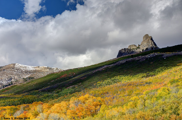
Most of the spectacular color comes from aspen trees.  The orange and yellow color variations and occasional bare trees are a photographer’s dream.  Isolating the trees from the mountains creates a tapestry of color.
This was the beginning of my 46th trip in 35 years of camping with my California photo friends, and it was a great start.

My photos are copyrighted, so please do not use them for any purpose without my permission.