Wednesday, September 25, 2013

Gilmore Ghost Town, Idaho

My wife, Linda, was away for a few days on a trip with her sisters, so I decided to make a quick run to the Birch Creek kilns and to Gilmore, a ghost town in the mountains of Lemhi County, Idaho.
The first stop was five miles up a dirt road at the beautiful Birch Creek kilns, which once supplied charcoal for the smelter at nearby Nicholia.  There were once 16 of these beehive kilns, and most have disappeared, along with most of Nicholia.  A storm came in fast while I was here, and I left in a thunderstorm with plenty of rain and hail.
When I got to nearby Gilmore the temperature was in the 30's and the wind was howling.  Soon the storm caught up and I had to try to take pictures in really difficult conditions.  The Gilmore Mercantile building looked suitably ghostly through the rain and hail on my windshield.


There are probably about 25 old buildings scattered over the hillside, with a mix of modern trailers.  Some of the old houses have been converted to summer cabins, but most are abandoned and decaying.

The entire front of this house was missing, so I could photograph the peeling wallpaper and crooked door.


The next day promised better weather, so I camped at the city park in Leadore to wait out the storm.  It got very cold during the night, and I woke up to snow on the hills and frost in the park.  I'm sure people were wondering why I was crawling around in the frost with my camera.


Gilmore was a silver and lead mining camp called the Texas Mining District.  At one time 600 people lived there and it was the second richest silver mining area in Idaho, but in 1929 a power plant exploded and the area never recovered.  Until then, the Gilmore and Pittsburgh Railroad transported ore to Montana for smelting.  The prosperous town had a hotel, stores, banks, restaurants, and a school.


Morning brought a crisp, clear day.  I returned to Gilmore to explore the town in better light.  I don't think there is a straight line or a level building anywhere in the town.


Gilmore is located between Mud Lake and Leadore, Idaho.  It is well worth the trip for ghost town hunters and photographers.

Sunday, September 8, 2013

Flying Over Bear Lake Valley


Every year the LOTOJA bicycle race passes through the Bear Lake Valley.  It is the longest sanctioned one day bicycle race in the country, and it goes from LOgan, Utah TO JAckson, Wyoming - 206 miles.  I was invited by a friend, Jim Parker, to photograph the event from the air, and he asked Rodger Sorensen if he would give us a ride.  Rodger brought his 1979 Maule four seater from Soda Springs to Bear Lake County Airport.  It was great.  No TSA, check-in lines, tickets, baggage, or hassles.  The first thing they did was take off the door so I could get a better view!  I had the back seat next to the non-existent door, and Jim sat up front with a small porthole to shoot through.

The weather was heavily overcast so the light wasn't too great.  I set the camera for a high ISO, opened the aperture all the way, checked my seat belt, and started shooting.  We found the racers on the highway from Emigration Canyon to Montpelier and got a few photos.
There is so much to see from up there.  Rodger took us as far as Copenhagen Basin summit, then turned back toward the valley.  The ride was incredibly smooth and he gave us a steady platform for photographing scenes like this farm.

We flew over the valley and continued east over the Preuss Range to the Geneva, Idaho area, then turned south toward Bear River.  The fields, creeks, river, and irrigation ditches made wonderful geometric patterns.
Near Pegram, we passed a train as it went under some power lines.  I thought the towers added an interesting perspective for the view from above, and the sun came out for a moment.
We flew over this beautiful green field with its single red tractor.  I could show you a lot more, but we returned to Bear Lake Airport.


After a perfect landing, Jim and Rodger replaced the back door and posed for a photo before Rodger took off for the return trip to Soda Springs.


What a great experience.  Thank you, Rodger and Jim for a wonderful morning and a smooth flight.  I would fly with these guys anytime.

Monday, September 2, 2013

Old Idaho Penitentiary

I was with Linda and her sister Jo Ann in Boise, Idaho, where we met Lisa, a friend from my 365 project, and went to the Old Idaho Penitentiary State Historic Site.  The penitentiary was used as a prison from 1870 to 1973 and is a picturesque complex of old and newer stone buildings.
There is so much history here.  For example, this building dates back to 1872, but was destroyed by fire in a 1973 prison riot.
This guard tower overlooks a beautiful rose garden which was the site of six executions by hanging.  Inmates could watch the gallows being built from Death Row.
This is one of the older cell blocks, and it is an incredibly eerie place.  There was one small radiator to heat a huge, four story room.  It must have been extremely cold and dark in those tiny cells, and until 1928 none of the cell blocks had indoor plumbing.  Before then, a "honey bucket" in the corner of each cell was the toilet.


Several of the buildings gave chilling hints about what it must have been like to stay here.  Just imagine what it would have been like to use this community shower with other inmates who probably were not very nice people.  There were also exhibits of prison tattoos, weapons, and more.


The laundry room was one of my favorites.  There were a lot of mysterious machines in a poorly lit, dusty room.  This crank was a good subject for black and white photography.  Because of the lack of light, a tripod was a necessity inside.


If you decide to go, look for details.  They are everywhere.  This sign nearly blended with the background until I played with contrast and converted it to black and white.

The Idaho Botanical Gardens are right next door, so if you visit the penitentiary with someone who does not enjoy this eerie place, send them into the sunlight and flowers.

But, I think it is a fascinating photo op.


Tuesday, August 20, 2013

Burke, Idaho Ghost Town

A few years ago, Linda and I visited the old mining ghost town of Burke, Idaho.  It is located in a canyon so narrow that every inch was used for something.  Hillsides were shored up with logs to create platforms where homes could be built.
This old postcard shows a street so narrow that cars had to stop and wait whenever a train went by.  The Tiger Hotel spanned the canyon so that a street, the creek, and two railroad tracks went through the lobby.
Most of the homes and stores disappeared when the mines closed, but there are still massive buildings standing from the mines.  In fact, they are easily the biggest buildings I have seen in a ghost town.
One of the stops on my annual camping trip in July was a return visit to Burke, but this time with my camping buddies, Bruce Gregory and Stephen Johnson.  This photo shows the huge ore bins at the bottom of the hill below the mine and mill.  There are tunnels through these huge concrete structures where trains used to run for loading.  As you can see, the complex is fenced, so we thought all we could do was photograph it from the road.
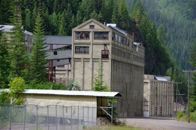
But, we got lucky and met a part time resident of the area who used to work in the mine, and who offered to take us on a tour.  We were able to go inside the giant Hecla mining compound and photograph these huge abandoned buildings.  This one is the hoist house for the mine.  There is much more information about Burke, and many more photos, on my web site here:  http://www.hisandhersphoto.com/ghost/hhburke.htm.

Tuesday, July 23, 2013

Steptoe Butte, Washington

Steptoe Butte is a high quartzite island rising above the beautiful rolling hills of the Palouse in southeastern Washington State.  I was on an annual camping trip with two friends, Bruce Gregory and Stephen Johnson, and we decided to photograph the landscape at sunset from the Butte.  We wanted a viewpoint that would look across the hills instead of straight down on them, so we drove about half way to the top and waited for sunset.
The sky was gorgeous, but the beautiful clouds blocked the sun from touching the ground below.  All we could do is wait, and hope the sun would drop below the clouds before it went below the horizon.
And then it happened.  The sun found a slot below the clouds and sweet light touched the tops of the hills below, lighting the immaculate farms of the Palouse.
A grain elevator stood out like a beacon in the soft light.
We had five minutes, or less, to capture the rolling landscape before the sun disappeared.  As I was photographing these hills, the light went flat almost without a transition.  It was an amazing evening.  We had waited an hour or so for the light, and when it finally came, we captured a few memorable images and the show was over.  We will have to return to Steptoe Butte again soon.

Monday, June 24, 2013

Arrowleaf Balsamroot Wildflowers

Our area has large fields of arrowleaf balsamroot wildflowers every spring, but this year is exceptional.  This hillside in Sharon, Idaho is mixed with sticky geranium (cranesbill) and field mint.


Arrowleaf balsamroot are large, showy wildflowers that grow on open hillsides.  Deer and elk often graze on them.


The second and third photos were taken in Emigration Canyon, Idaho.


This shot was taken by placing the camera on the ground and aiming up without looking through the viewfinder.


The last photo was taken near Salt River Summit in Wyoming.  The hillside was covered with arrowleaf balsamroot, but I found some purple lupine to place in the foreground.
What a treat for photographers!

Tuesday, April 30, 2013

Little Planets

Here's a fun creative Photoshop project that is much easier than it looks.  To get your attention, I will start by showing you the end product, then describe how it was done.  My title for this photo is "America On A Stick".  It was taken in an area of Wells, Nevada that was destroyed by an earthquake in 2008.  An American flag has been painted on a wall next to ruins that have been neglected ever since the earthquake.
I used Photoshop Elements version 9 for this project.  The hardest part of this is to pick a photo that will work well.  It helps to have a photo that has sky colors that match on the left and right edges, and a horizon that is the same height on each edge.  Here is the original photo:
I rotated this photo left 2.5 degrees (Image > rotate > custom) to get the tops of the far left and far right buildings even, then cloned out the power line across the sky.  It helps to overlay a grid across the image to get it even (View > Grid).  The next step is to rotate the adjusted image 180 degrees (Image > rotate > 180)
The next step creates the Little Planet.  The results are pretty unpredictable, so it is always kind of exciting to see what happens.  Filter > Distort > Polar Coordinates.  Select "Rectangular To Polar" and click OK.
Next, fine-tune the image.  In this case, I chose to rotate it back so that the lamp post was on the bottom.  I also blended the line in the sky and some other parts of the same line using the healing brush and clone stamp tools.  Many images will have distracting patterns in the corners that you may want to crop out or retouch.  The final image, as seen in the beginning of this post, was stretched to a circle.  Resize > Image Size, then uncheck "constrain proportions" and type in new dimensions so that width and height are equal.  Finally, crop, retouch, and adjust as desired to get your masterpiece.